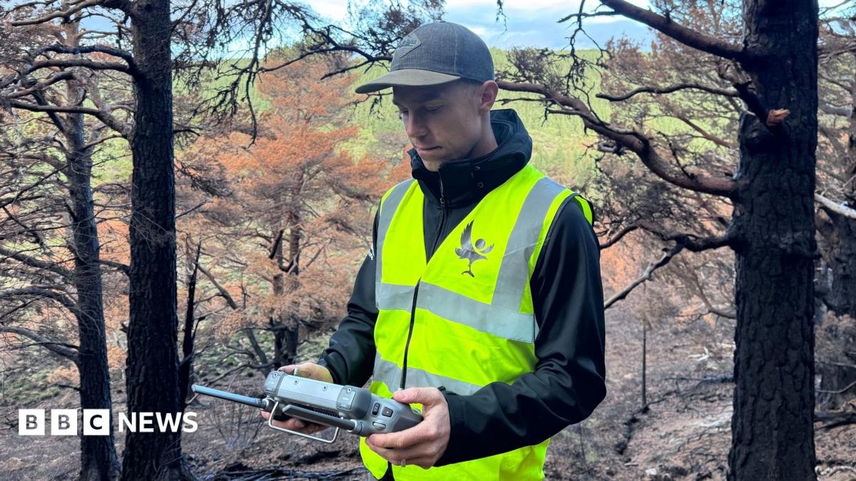
Image caption, Drone pilot Pete Short hunts for hotspots in the Cairngorms National Park which was devastated by a huge wildfire over the summer ByShiona McCallumSenior technology reporter Published 3 minutes ago It is 06:00 and I'm meeting drone pilot Pete Short for a dawn patrol in the Cairngorms National Park.
It is a job he has been doing for almost three months, since a huge wildfire tore through this landscape in July.
The flames which swept across the hillsides are gone.
From where we are standing, there is little to suggest there is still a fire here at all.
But that is exactly what we have come to find.
After a bumpy drive into the woodland, Pete launches a thermal drone into the early morning sky.
I am given a job too: keeping the aircraft in sight while he studies the images being sent back to his screen.
"Every week I hope that I find none," he tells me.
"On the last thermal flight I did we found eight." It doesn't take long.
"We might have something here," Pete says, as a white glow appears on the thermal image beneath a tree.
Three months after the fire first ignited, heat is still being detected beneath the ground.
We make our way towards the coordinates identified by the drone, and at first, there is almost nothing to see.
Then we feel it.
The soil is warm.
A rock Pete picks up from the ground is, too.
Nearby, after scraping away a thin layer of earth, smoke begins to rise.
"It's really now cooking away," Pete says.
"Without the thermal technology we would be totally blind to this." Fire beneath the ground The wildfire began in the middle of July and burned across about 3,300 hectares – 33 sq km – of land, according to the Cairngorms National Park Authority.
At the height of the emergency, five experienced drone pilots were brought together to provide aerial information to the agencies fighting the fire.
Pete describes it as one of the most challenging environments he has ever flown in, with "multiple walls of flame", personnel and vehicles moving around the site and helicopters operating overhead.
Now the challenge is different.
The dramatic flames have disappeared, but hot spots can continue to burn beneath the earth.
Figure caption, On the scene at the Cairngorms wildfire Each one found by the drones is reported to the land manager.
They send teams who can dig into the ground and douse it with water.
For Ben Jones, senior site manager for the RSPB at Abernethy, knowing exactly where to send those teams has been crucial.
"We've been fighting this fire for over two months now and obviously we've got limited resources in terms of the number of people we have and we can't send everybody out everywhere all the time," he says.
"So we really need to know where these specific hot spots are - where we should be sending people - so that they can be as efficient as possible." And despite the arrival of colder, wetter weather, the remaining fires cannot simply be ignored.
"Each of these hot spots has got the potential to reignite a larger fire," Ben says.
A landscape transformed Walking through the forest, the scale of what happened is almost haunting.
Tree trunks are blackened and charred.
The acrid smell of fire still hangs around.
Large areas of the forest floor have been scorched.
But look closely and there are splashes of colour.
Green shoots are emerging.
Fungi is growing.
I even spot a small yellow flower shooting up from the blackened ground.
Dr Sarah Henshall, head of conservation at the Cairngorms National Park Authority, says it is too early to know the full ecological impact of the fire.
Image caption, Dr Sarah Henshall says drone information will show how the park is recovering "Some of that will be incredibly quick, some of it will take years, decades, or even beyond our lifetime," she says.
"It will recover, but we just don't know what that's going to look like yet." And the drones that helped during the fire - and are still searching for what remains of it - are being given another job.
Pete is programming them to repeatedly fly exactly the same routes over the damaged landscape.
Using predetermined waypoints, photographs and video can be taken from the same positions month after month and year after year, allowing conservationists to build up a picture of how the landscape changes.
"This standard drone route will have exactly the same route flown month by month, year by year and visually it's going to give us some amazing information about how it's recovering," Sarah says.
There could be another role for the tech too - spotting future fires before they have a chance to spread.
Pete believes getting a view above the tree canopy quickly could prove critical.
"It's those moments before a wildfire gets out of control that could be critical to stopping it before it gets out of hand," he says.
Back on the ground, our patrol has found another hot spot.
Again, there is almost nothing visible from a distance.
But guided by the drone, we find the precise spot.
Beneath a thin layer of earth, it is hot and the smoke becomes obvious after we stoke the soil.
Another location to report.
Another fire for the ground teams to extinguish.
Above us, the forest is already showing its first signs of life but below our feet, the last of the fire is still burning.
Last firefighters stood down from scene of Cairngorms wildfire Published 18 August Sign of life as bright orange 'fire fungus' grows at park ravaged by wildfire Published 14 August Firms affected by Cairngorms wildfire offered support from £3m fund Published 6 August Sign up for our Tech Decoded newsletter to follow the world's top tech stories and trends.
Outside the UK?
Sign up here.