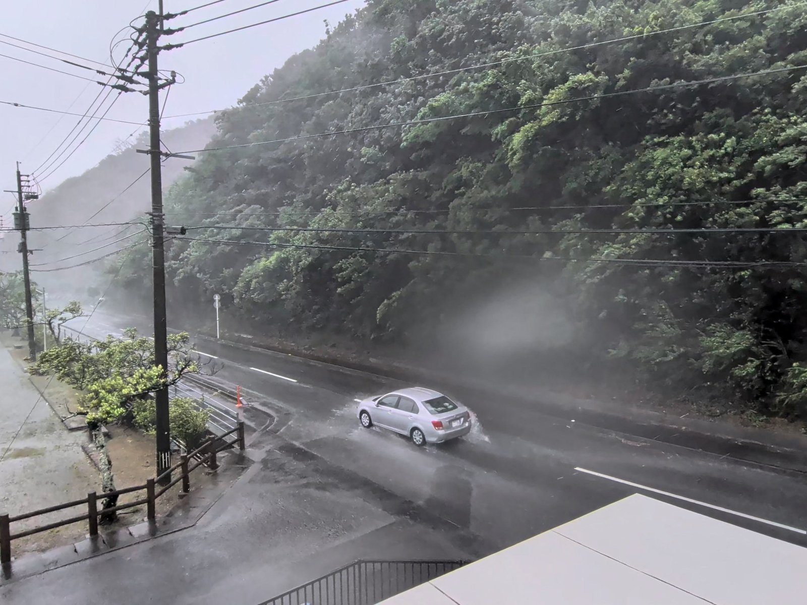
A car makes its way through strong winds and rain as Typhoon Dolphin approaches, in Nazeasahicho, Amami, Kagoshima, Japan [File: Screengrab obtained from a social media video @darider5/X/via Reuters] By Al Jazeera Staff, Reuters and The Associated Press Published On 8 Aug 20268 Aug 2026 Typhoon Dolphin has hit Japan’s southern island of Okinawa, injuring five people and cutting power to 14,000 buildings, and is heading towards eastern China, where authorities have shut down ports, schools and tourist sites.
Okinawa Island, and Amami Island in Kagoshima prefecture, are the main areas affected in Japan.
Five elderly people suffered non-life-threatening injuries, with three falling due to the wind, the Okinawan prefectural government said.
Dolphin has caused flight cancellations in Okinawa, as well as in China and Taiwan.
The typhoon, named after Hong Kong’s Chinese white dolphin, comes amid a record-breaking heatwave in East Asia.
Three lions in a Japanese zoo died from suspected heatstroke, while in South Korea, the extreme temperatures were blamed for more than 20 deaths.
Dolphin grew out of a tropical depression that emerged on July 26, moving at 45 kilometres per hour (30 miles per hour) over the open waters of the Central Pacific Ocean as it embarked on a journey of several thousand kilometres across the Pacific.
Over the course of its journey, it strengthened to a tropical storm and then to a severe tropical storm before burgeoning into a typhoon and then a very strong typhoon on July 28. (Al Jazeera) On Saturday, Dolphin was about 160km (100 miles) northwest of Kume Island in Okinawa as of 03:00 GMT, moving northwest at 15km/h (9mph), the Japan Meteorological Agency said.
It had maximum sustained winds of 162km/h (100mph) with gusts reaching 216km/h (134mph).
As the storm is heading towards China’s eastern coast, national authorities have declared a level-three emergency response, the second lowest level.
Advertisement According to the China National Meteorological Centre, Typhoon Dolphin is expected to make landfall along China’s eastern and southern coast between late Sunday and early Monday, most likely between Zhoushan city in Zhejiang province and Fuding city in Fujian province.
Rain and strong winds are expected to affect eastern China through August 12, including parts of Shanghai and neighbouring provinces.
Some areas of eastern Zhejiang could receive more than 600mm (23.6in) of rain, according to forecasters.
Zhejiang raised its coastal typhoon alert to its highest level, halted port operations and suspended 162 passenger ferry routes.
Authorities in Ningbo, one of the province’s largest cities, ordered the closures of schools, other educational facilities and all water-related activities this weekend.
Ningbo Lishe International Airport in Zhejiang also said it would halt operations from 11:30pm (15:30 GMT) on Saturday and suspend all flights on Sunday.
Shanghai’s Yangshan port has been cleared of vessels, while some rail services in the Yangtze River Delta will be suspended from Sunday.
Meanwhile, Taiwan has also cancelled 63 international flights because of the typhoon, the government said.
Heavy rain was expected in northern parts of the island over the weekend, though authorities had not ordered evacuations as of Saturday.
China has ordered that, due to the typhoon, ships passing through the Taiwan Strait must heed its traffic control instructions – measures that Taipei denounced as “ridiculous”, saying Beijing has no right to restrict access to international waters.
China views democratically governed Taiwan as its own territory and claims the strategic strait.
Taipei rejects that claim.